Utah Built 2,000 Arches and Then Added a Canyon Maze
Moab, Utah, is what happens when geology gets ambitious, ignores sensible proportions, and spends millions of years decorating the desert. On one side of town, Arches National Park has more than 2,000 documented stone arches, plus fins, towers, windows, and Balanced Rock, which appears to be waiting for one careless pigeon. On the other side, Canyonlands National Park has canyons inside canyons, roads that become arguments, and four districts that refuse to connect by road.
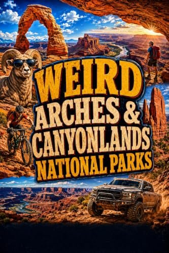
WEIRD ARCHES & CANYONLANDS NATIONAL PARKS explores both parks, the backcountry around Moab, and the strange stories hiding behind all that red rock. It is for travelers who want Delicate Arch and Mesa Arch, but also want uranium boom history, ancient rock art, peculiar desert creatures, movie locations, and a realistic explanation of why “passable when dry” is not a comforting road description.
Arches Is Slowly Falling Apart, Beautifully
The arches were not carved by prehistoric stonemasons with excellent taste. The landscape began with buried sandstone, enormous underground salt deposits, uplift, fractures, and a great deal of patient erosion. Water entered cracks, freezing temperatures widened them, and softer rock disappeared. Thick walls became fins. Fins developed openings. Openings grew into arches. Eventually every arch will collapse, which is geology’s way of reminding visitors not to procrastinate for several thousand years.
To qualify as an official arch, an opening needs to measure at least three feet in one direction. That standard has produced more than 2,000 documented examples, ranging from famous giants to skinny openings that barely seem committed to the idea. Delicate Arch receives most of the celebrity attention, while Landscape Arch stretches improbably across Devils Garden and looks like a stone ribbon that forgot gravity was invited.
The practical trick is to match the visit to your energy level. The Windows, Double Arch, Balanced Rock, and Delicate Arch Viewpoint deliver major scenery with relatively short walks. The hike to Delicate Arch demands more effort, exposed slickrock, and enough water. The Fiery Furnace is a sandstone labyrinth where confidence can wander off without you, so entry requires a reserved permit or a ranger led hike.
Canyonlands Is Four Parks Wearing One Name Tag
Canyonlands is divided by the Green and Colorado rivers into Island in the Sky, The Needles, The Maze, and the river corridors. No road connects all four districts. A map can make them appear politely adjacent, but the actual driving time says otherwise. Visitors who try to “see Canyonlands” in one casual afternoon often discover they have seen one overlook, three ravens, and a surprising amount of dashboard.
Island in the Sky is the easiest district for a first visit. The paved scenic drive reaches huge overlooks, and Mesa Arch frames the canyon country like nature built its own postcard stand. The Needles rewards travelers with striped sandstone spires, longer trails, and a landscape that feels more intimate and maze like. The Maze is the remote one. It expects four wheel drive, self reliance, time, preparation, and a vehicle whose owner will not panic at the first scraping sound.
Then there are the rivers, which did most of the carving and still run through the middle of everything as if inspecting their work. From above, Canyonlands looks solid. Up close, it is a vast layered puzzle of mesas, buttes, shelves, spires, washes, and drop offs. The geology is not merely scenery. It determines where roads can go, where water collects, and why a destination that looks close may be separated by a canyon large enough to have weather.
Please Do Not Step on the Tiny Desert Civilization
Some of the strangest life in Canyonlands occupies natural potholes in the sandstone. After rain, these shallow basins become temporary ecosystems. Tiny creatures hatch, swim, reproduce, and prepare for the water to vanish. Tardigrades can enter an extreme resting state and wait for another storm, displaying more patience than the average person stuck behind a rental motorhome.
The correct way to admire a pothole is from the edge. A footprint can damage eggs and organisms waiting in the dry sediment. The same care applies to biological soil crust, the dark, bumpy desert surface that helps stabilize soil and support plant life. It may look like ordinary dirt, but trampling it is less like stepping on sand and more like kicking over a very small apartment complex.
People Were Here Long Before the Scenic Drive
Human connections to this country stretch back more than 10,000 years. Rock markings, structures, trails, and cultural sites remain throughout the region, and many Native nations maintain enduring ties to the land. These places deserve more than a quick photograph. Do not touch rock art, enter closed structures, move artifacts, or leave your own contribution. Nobody needs “Brad 2026” scratched beside a story that survived centuries without Brad.
Moab’s more recent history brings ranchers, explorers, miners, filmmakers, and the uranium boom. Roads pushed into canyon country looking for ore and later became routes for recreation. Hollywood discovered that the landscape could impersonate almost any dramatic planet. The result is a town where trail guides, old mining stories, mountain bikes, river rafts, and film history all compete for room beside the coffee shops.
How to Avoid Becoming Ranger Paperwork
In 2026, Arches does not require an advance timed entry reservation. A park pass is still required, parking can fill, and congested areas may be temporarily restricted. Arrive early or visit later in the day, check official conditions, and keep a flexible backup stop. Reservations are still required for Devils Garden Campground and Fiery Furnace hikes. Canyonlands visitors should decide which district they are visiting before leaving Moab, because “all of them” is not a route.
Carry serious water. Arches recommends planning for at least one gallon per person per day. Shade is scarce, cell service is unreliable, and a sunny sky does not eliminate flash flood danger elsewhere in a drainage. Stay off arches, remain on established routes, protect soil crust, and never assume a backcountry road is suitable because a map printed it with an innocent little line.
Take the Book Into the Red Rock
WEIRD ARCHES & CANYONLANDS NATIONAL PARKS combines strange history, practical planning, scenic drives, walking adventures, mountain bike routes, off road challenges, and the stories behind Moab’s most famous formations. It helps readers decide what fits their time, vehicle, tolerance for heights, and willingness to return home with red dust in places red dust should not be.
Explore more odd American journeys on the Weird America series page, or browse the full SparkTrail Press book catalog.